After reading the W1GHZ GaAsFET LNA Bias entry, I wanted to see what the performance of these exposed-base optocouplers are. The concept comes from the IEEE Microwave Journal Application Notes: Photovoltaic Bias for Depletion-Mode Devices in Low-Noise Amplifier Applications (DOI 10.1109/MMM.2022.3226635). It's not open access, so I figured some publicly available characterization data would be cool to share. I have access to a dual-channel precision SMU (source-measure unit, Wikipedia ) and that's exactly what we need to characterize the photovoltaic behavior of optocouplers! Keysight B2902B SMU front panel during a 20 mA input, open circuit output measurement
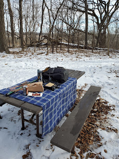
It was a nice day in Wisconsin and, having taken Friday the 25th off for video gaming, it was a nice change of pace to throw in some POTA in a new location on Sunday the 28th. The actual intention was getting to K-1459 Lake Kegonsa State Park ( wiki ), which I definitely managed to do. I'll get to the RaDAR in a bit. On the way out of town, I stopped by Bagels Forever, a local bagel factory with walk-in service counter serving a full selection of options. I chose my standard sausage-egg-and-cheese, gouda, on sesame with two additional cold plain bagels since they were out of chocolate chip and bagel sticks. These are key to getting set up! Getting setup on a picnic table at the snowy Williams Knoll as the bench dries out
I've been sitting on my to-be-modded UV-K5 for a while now in hopes of having low-cost access to more bands . In my diversion from this project, others have put together some good work, though at the low end of the range. The ludwich66 GitHub wiki tracking UV-K5 projects covers them on the Hardware_Mods_27Mhz page . The two sets of PDFs were uploaded back in July 2024. Yeah, I'm behind a bit. Let's dive into what's been implemented.


Comments
Post a Comment